Cycling stories
Sa Calobra: the making of a road
Built to bring visitors into Mallorca’s mountains, Sa Calobra became a destination itself. The story of Antoni Parietti’s road, its extraordinary bends and the cyclists who followed.
By Montivelo · · 8 min read
Hero photograph: Adam · Personal collection.
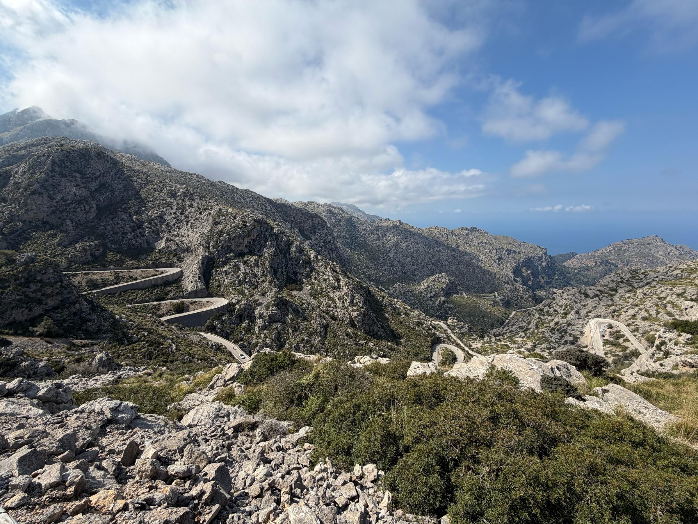
Near the summit of Sa Calobra, the road twists back on itself in one of Mallorca’s most distinctive features. Known as the Nus de sa Corbata, or “knot of the tie”, this remarkable section of road forms a sweeping 270-degree loop, passing over itself on a stone bridge. From above, its unusual shape is unmistakable. From the saddle, it unfolds gradually through a series of tight bends, revealing another dramatic piece of the mountain with every turn.
Below it, the road keeps folding. Pale rock rises between successive stretches of tarmac. Supporting walls hold the outer edges above slopes too steep to carry a road unaided. From above, several bends can occupy the same view, their apparent closeness concealing the distance between them. Beyond the mountain lies the sea.
This elaborate route has a small coastal destination. Its scale makes more sense when the journey is understood as part of its purpose. Sa Calobra’s road was built to bring visitors into this landscape. Decades later, cyclists would give the bends another meaning, turning the return from the coast into one of Mallorca’s defining rides.
A road for visitors
In the early twentieth century, opening the Tramuntana to visitors was an ambition that required roads. The scenery was already there; access for motor vehicles had to be made. A mountain slope could separate an inviting coastal place from the people who might travel to see it, and overcoming that separation offered a way to develop tourism.
Antoni Parietti Coll stood at the meeting of those interests. Born in Palma, he headed the provincial government’s roads department and also served as chairman of Foment del Turisme, Mallorca’s tourism promotion organisation. The combination helps explain his work. A line on an engineer’s drawing could become an excursion, a view reached by car, a reason to spend another day exploring the island.
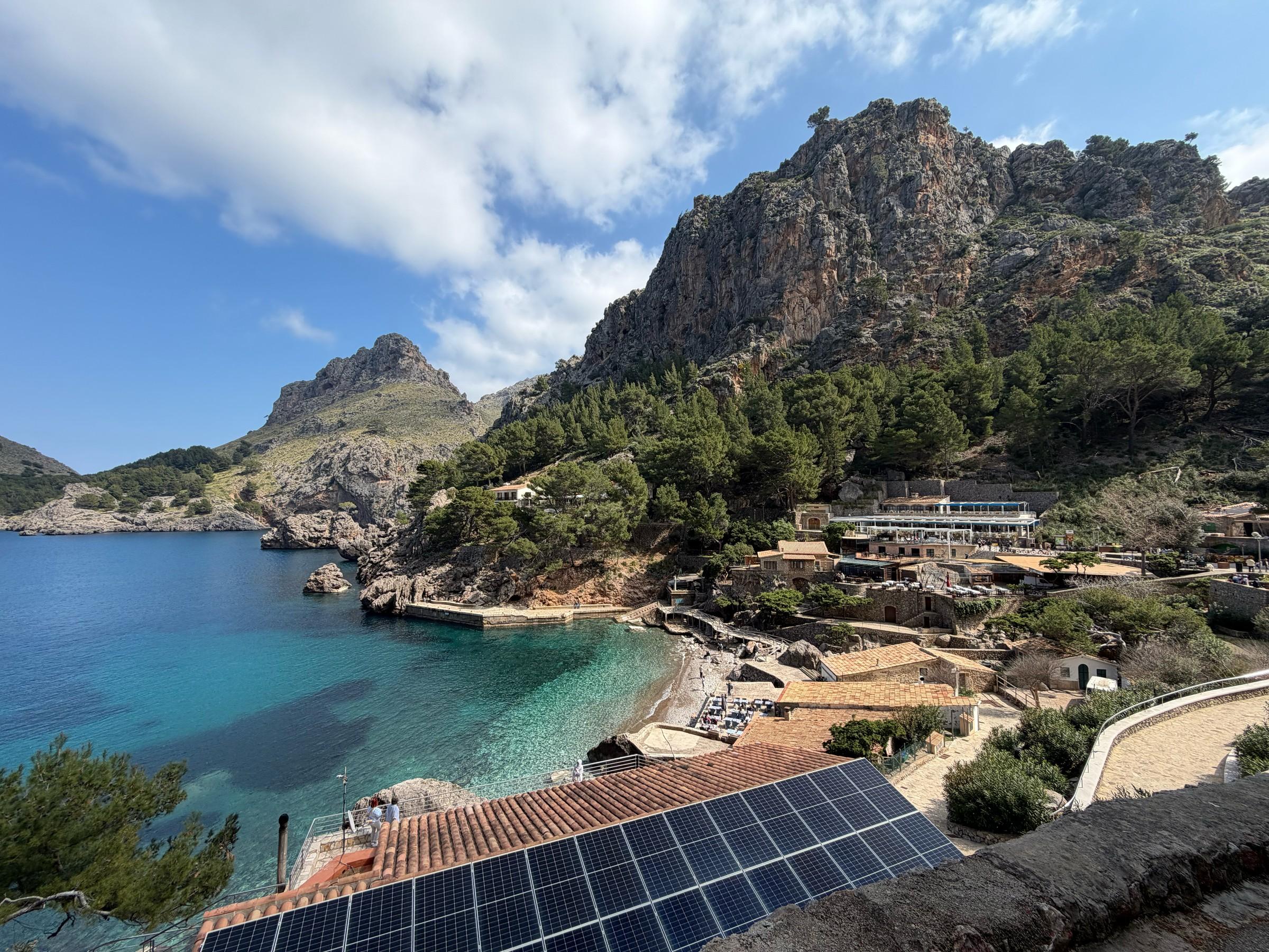
His road from Port de Pollença towards Formentor preceded Sa Calobra. Both projects opened exceptional stretches of landscape to visitors. Their purpose extended beyond the ordinary business of connecting settlements: they made places accessible because people would want to look at them. The coastal destination justified the road, while the road gave the destination a new public life.
Sa Calobra took shape in the early 1930s, before the island’s later mass tourism. Its curves belong to that earlier ambition to make a mountain journey possible by motor vehicle. Seen in this context, the road’s ending beside the sea is entirely logical. It delivers visitors to the place they came to see, even though they must retrace it to leave by road.
There is a tension within that achievement. Access changes a landscape as well as revealing it. Building a road makes a physical intervention; bringing visitors creates another. Sa Calobra’s appeal now includes the conspicuous line of the road itself, so thoroughly has the means of reaching the coast become part of the view.
Finding room on the mountain
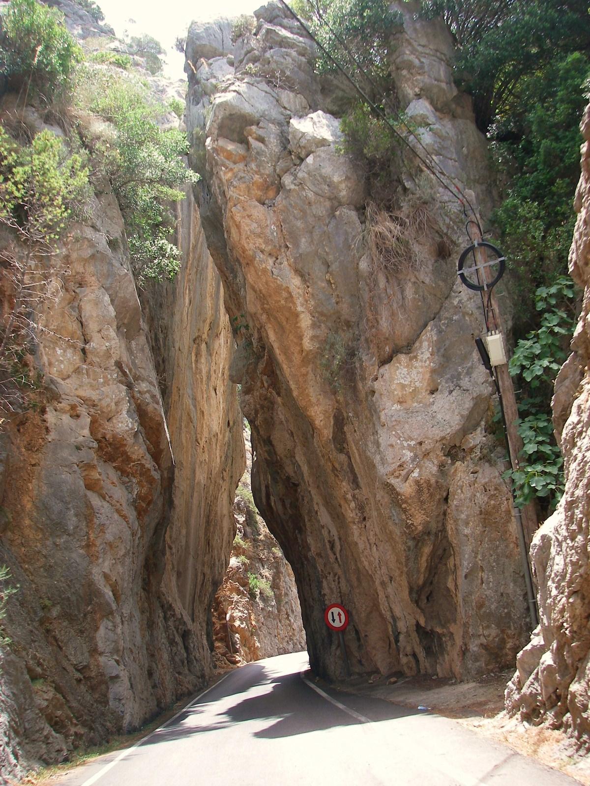
The road passes between tall rock faces on the way to Sa Calobra. Straightened and cropped for display. Photo by Mickey Løgitmark on Wikimedia Commons · CC BY 3.0

The basic difficulty is visible without an engineering drawing. The road has to connect high ground with the coast across steep, broken terrain. A direct line would be shorter on a map and much steeper on the ground. By travelling across a slope, then turning back across it, a road spreads the change in height over a greater distance. The bends provide length where the mountain offers little horizontal room.
Each turn also has to meet the ground. The road needs a surface wide enough to travel on and support beneath its outer edge. Where the hillside falls away, masonry holds a terrace on which that surface can rest. From across the slope, the walls reveal the scale of the task more clearly than the strip of tarmac above them. They turn a narrow line into a substantial piece of construction.
Those supporting walls were built by hand. It is a useful detail to hold against the view from above, where the curves can seem almost effortless. The road required excavation and the movement of rock and earth as well as careful alignment. Its apparent ease within the mountain was made through labour. The vegetation and exposed rock around the walls do not erase the work that put them there.
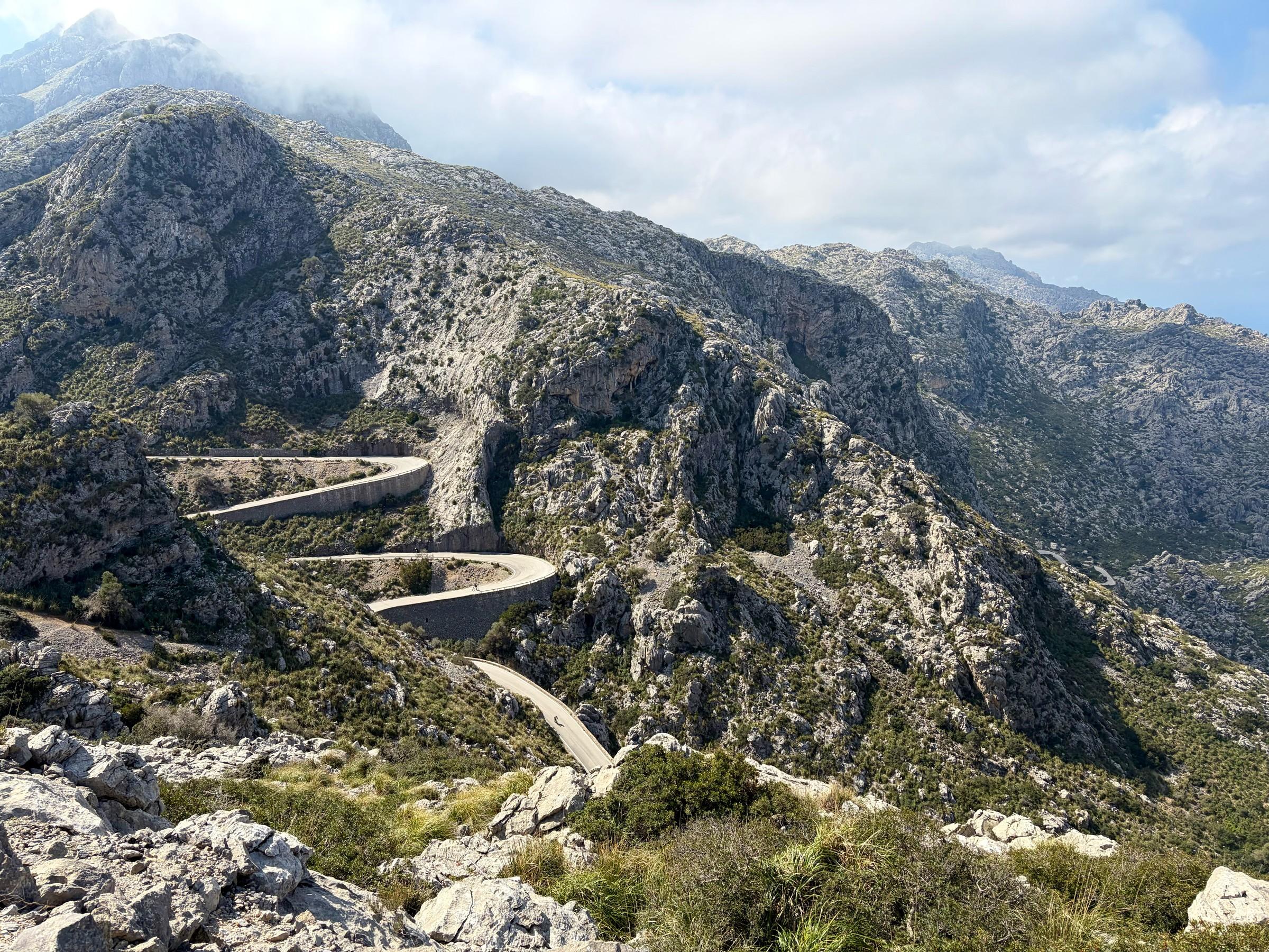
At the Nus de sa Corbata, the solution becomes particularly legible. The road curls through roughly three quarters of a circle and crosses itself at two different levels. Following the loop allows it to gain or lose height while returning to the same small area of mountainside. The bridge separates those levels. What looks like an extravagant flourish is also a practical arrangement of distance and height.
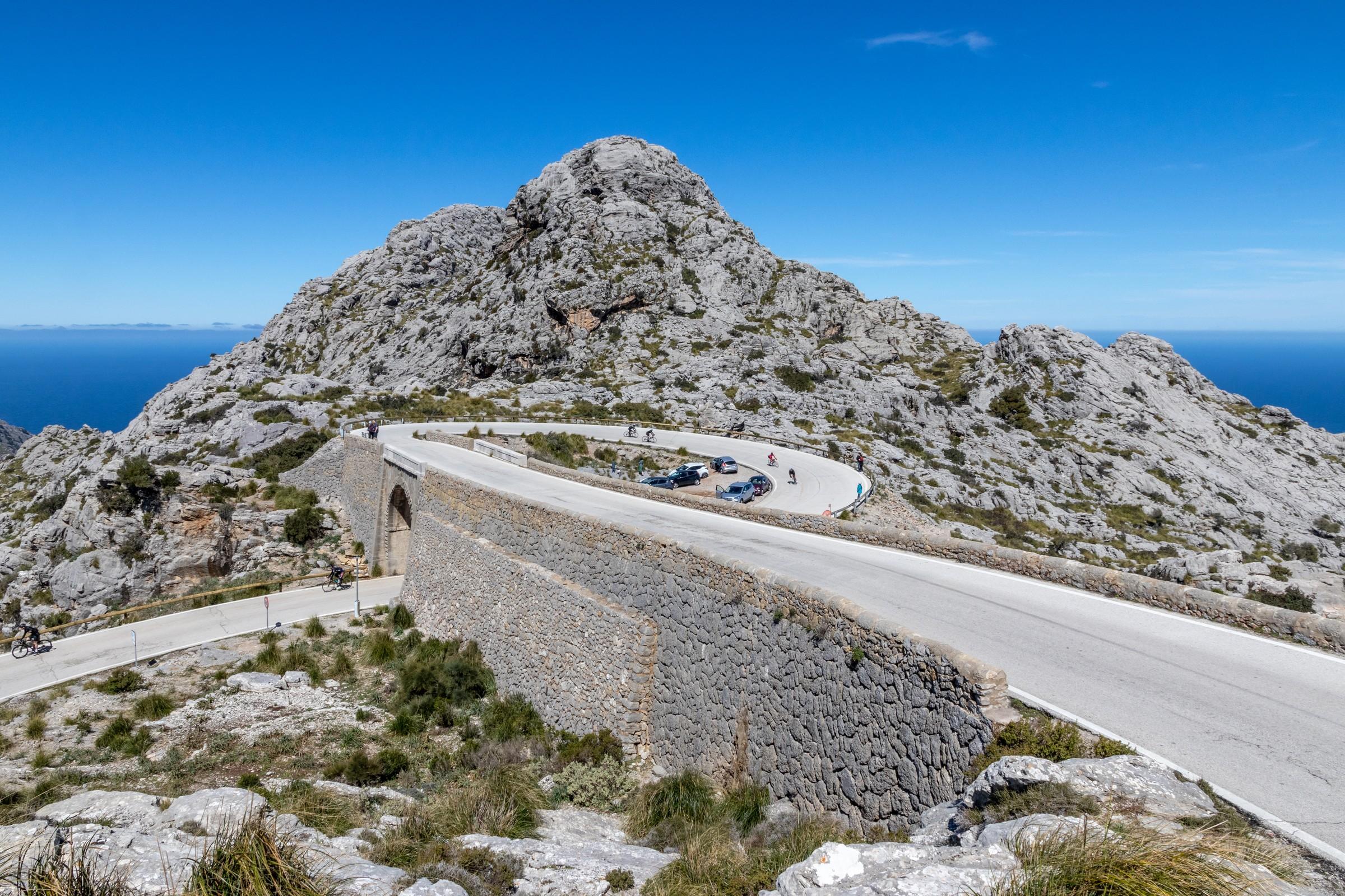

The knot draws attention because the idea can be grasped at a glance. Elsewhere, the same negotiation is spread across a larger slope: stretches running in different directions, walls stepping around the rock, the road briefly disappearing behind the terrain. A photograph compresses these parts into a pattern. Travelling through them restores their order and their separation.
That sequence matters to the character of Sa Calobra. A bend changes the direction of travel and the view ahead. Rock that stood beside the road becomes a face across the valley; a stretch just ridden appears above or below. There are places where the mountain fills the scene and others where the sea supplies its distant edge. The road gives the landscape a succession of frames.
It is tempting to read the finished route as inevitable, as though it had always been waiting in the mountain. The walls argue otherwise. They mark the points where a usable road had to be constructed out from the slope. Sa Calobra’s form comes from the relationship between the terrain and the work needed to cross it. Both remain visible.
Sa Calobra to Coll dels Reis
Escorca, Illes Balears
The climb back out
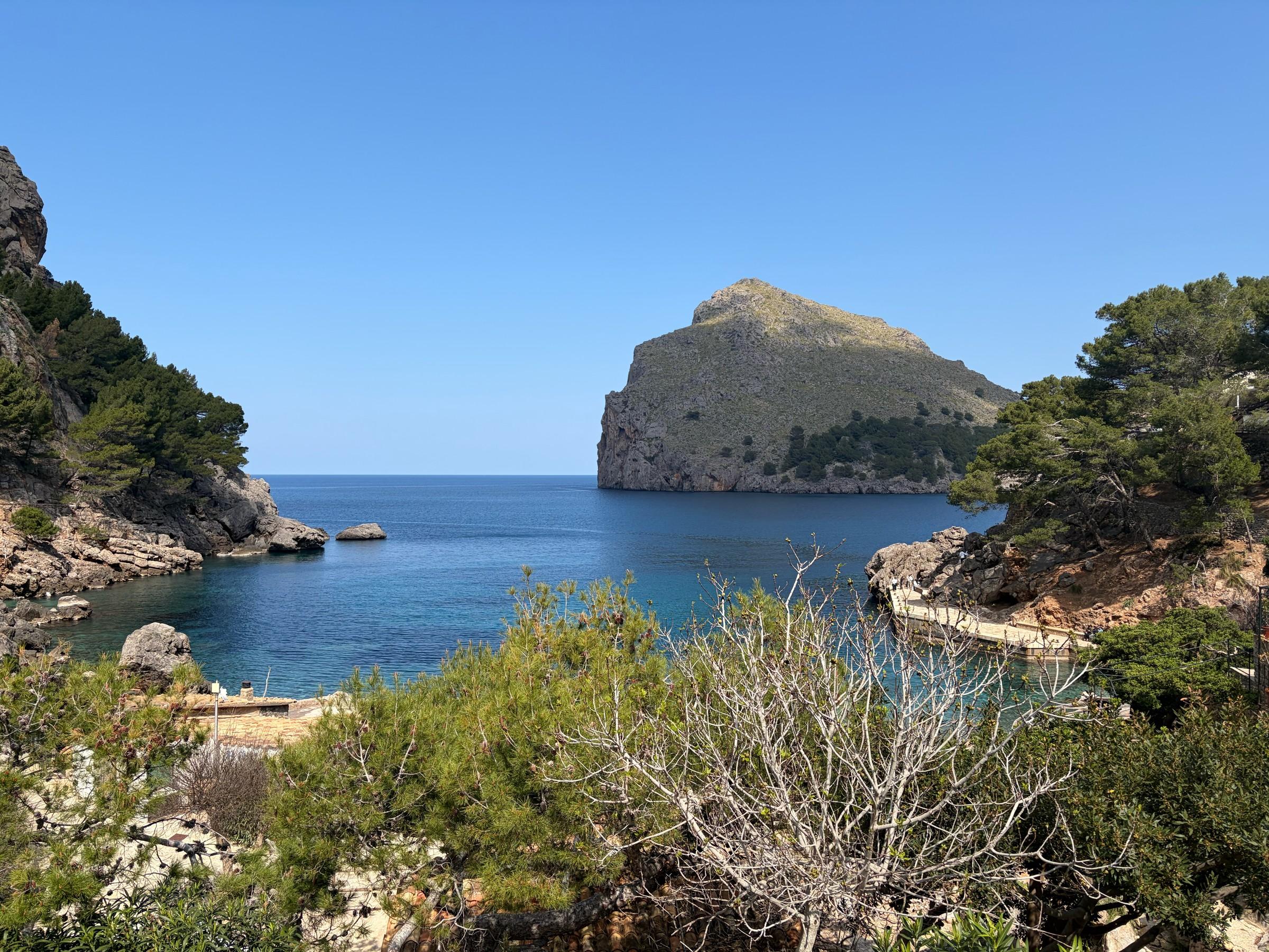
For cyclists arriving from the mountain interior, Sa Calobra presents its most familiar reversal: the descent comes first. Riders cross Coll dels Reis and follow the bends towards the coast before turning to climb the same road. The return is anticipated throughout the journey down. Every stretch that sheds height will have to be ridden in the other direction.
At the bottom, the outing has a clear turning point. The sea is close, the pass is above, and the way back follows the road already seen. This gives the ascent a particular kind of familiarity. Its shape is known before the climbing starts, although descending has offered little sense of how long each stretch will take under steady effort.
The bends change character on the return. A turn approached under braking becomes somewhere to carry a climbing rhythm into another direction. The stone walls seen from above become edges beside the rider. A piece of tarmac that flashed past on the descent takes time to unfold uphill. The road’s geometry becomes tangible through the time spent on it.
Sa Calobra was already an established destination for visiting cyclists by 2012. A club-riding account from that year describes a group heading from Pollença into the mountains, descending among holiday traffic and coaches, stopping by the sea and climbing back out. The essentials of the familiar outing were already in place: a shared journey into the Tramuntana, the coastal pause and the return through the bends.
Professional training added another use to the same road. In 2016, Chris Froome’s group at a Team Sky camp was assigned the climb with short accelerations at kilometre intervals. A road built to carry visitors through the scenery could also supply a measured training effort. The mountain remained the same; the reasons for travelling through it had multiplied.
Those professional associations sit alongside an amateur culture that was already established. Sa Calobra offers a recognisable destination within a longer day in the mountains. The sustained ascent gives the outing weight, while its repeated changes of direction make it easy to remember in sections. A photograph of the bends can call back a particular turn or the sight of another rider on the road above.
The traffic is part of this continuing story, too. The road still serves people visiting the coast by motor vehicle, and cyclists share its confined bends with them. Its origins remain present in that mixture. A cycling destination has grown within a tourist road, carrying the different speeds and expectations of the people who use it.
Back at the knot
Towards the pass, the road crosses itself again. After the ascent, the loop can be understood as more than a shape seen from above. Its separation into upper and lower levels has become height gained; the curve between them has become distance ridden. The bicycle makes the arrangement intelligible at the pace of a person working uphill.
Parietti’s road brought visitors closer to a difficult stretch of Mallorca’s coast. Along the way, it made a new feature of the mountain: walls, bends and a bridge that would become part of how the place is recognised. The cyclists came later, following the line that had been made available to them. At the knot, with another stretch of road overhead, the connection between their ride and that earlier work is unusually clear.